|
Floods - Types, Predictions And CausesSomeone is experiencing a flood today, somewhere in the USA. It may only be a minor inconvenience, or it may be a major disaster, butfloods are an important and inevitable part of the way water ismade available to all parts of this planet. Well, every day in 2004, somewhere in the 48 states was experiencing flood conditions. Now 2004 was not a particularly wet year, yet the distribution of rain and snow throughout the year was enough to cause flooding somewhere. (Yes, I realize that searching through a year's worth of flood reports is not one of life's highpoints, but the question arose, and I won't need to do it again.) These statistics are restricted to floods which occur in stream and river systems and are divided into two major categories - Flash Floods, which I have written about elsewhere, and the larger but more slowly developing river floods. More restricted, but often just as devastating, are the storm surges associated with hurricanes and other severe storms, most frequent on the East and Gulf Coasts.
And most devastating of all, although not weather related, are the big tsunamis such as the one on Boxing Day in Southeast Asia.
But in this article I'll restrict myself to the large, extensive and long lasting river floods. Most of these develop gradually, but sometimes devastating floods have resulted from the sudden failure of a man made dam. These catastrophes, which come with little warning, are rare and hopefully getting rarer.
Although they usually were associated with heavy rain which filled the dam before it broke, they are not really part of the normal river floods, and are not discussed here. However some of the more disastrous dam failures are the subject of excellent books, DVDs and videos, discussed in Part 3 of this review, More Flood Resources.
Part 2 reviews the Causes of River System Floods, and how to record and understand floods using your home weather station and other information. Apart from the wealth of information on all aspects of floods included in More Flood Resources (including posters and photos), there is some great information at Government websites such as NOAA, NWS and other national weather agencies. You'll find links to some of the better US sites, and they are well worth a visit.
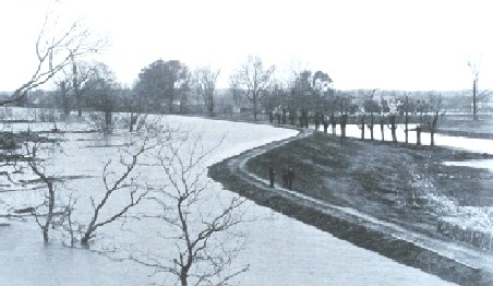
Note how much lower the floodplain to the right is.
They include the flood reports I mentioned above, which demonstrate that floods are a natural part of the hydrologic cycle - the vertical and horizontal transfer of water in all its states - vapor, liquid and solid - between land, sea and the atmosphere. And most floods simply represent a temporary loss of balance between the amount of rain or melted snow and ice entering a river system and the river's capacity to remove it.
Most river floods are minor spills of water over the banks of the river on to the adjacent floodplain. They cause a little inconvenience for a while, but provide natural irrigation and soil replenishment through the coating of mud and silt they leave behind.
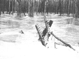
Bridge on left about to go.
Every so often the amount of water that must be moved vastly overcomes the river's capacity to handle it, and huge amounts of water spread out over the surrounding country. Houses and businesses are flooded, transport is disrupted, lives are put at risk and sometimes lost, and loss and damage to crops, farmland and property reaches extreme levels. When disruption is severe, a national disaster is declared and all efforts are concentrated on rescue, recovery and restoration of infrastructure, property and livelihoods.
Major floods on this scale usually take days, even weeks, from the time the river first breaks its banks until the last water drains away. Meanwhile the peak of the flood moves on down the river to affect other communities.

When a major river system such as the Mississippi is in flood, usually due to simultaneous major floods in several of its tributaries, the flood peak can take months to clear the system. That's why severe flooding can happen in areas where little rain has actually fallen. Such a flood happened in 1993.
Flood Forecasting
Forecasting a flood does nothing to reduce the height of the floodwaters, but an accurate forecast goes a long way to reducing the damage, cost and loss of property and life.
Evacuation plans, preparation of buildings and removal of their contents before the arrival of the water, early warnings to dam engineers and sewage plant operators, and notice to barge and boat owners all help to reduce the ultimate effects of a flood.
Forecasting has improved a great deal over the last 20 or so years and continues to do so. Some of the improvement is the result of research projects, notably by the National Weather Service's Hydrological Research Laboratory, together with many other organizations.
Major improvements have also come with the development of numerous river gauges, many of them automatic, and weather stations, all linked by computer to central forecasting offices.
Although computerization of data collection and analysis has been a huge help, the task of flood prediction is still not an easy one. Before an estimate of flood height and arrival can be made, estimates have to be made of three major components of a flood
All this information needs to be compared to history of previous floods to arrive at a best estimate for the height and duration of the flood. Once compiled, the information is incorporated in flood watches or warnings broadcast on Weather Radio and relevant websites. Information on river heights is also rapidly made available through the River Heights section on local NWS websites. Frequent updates are made to keep everyone up to date with the flood's progress.
A good place to start looking for current Flood Information is the Hydrologic Information Center's Home Page. By clicking on your location on the map on that page, you'll be taken to the office coordinating flood information for your area. The map there will allow you to home in on the river you are concerned about. You'll find a heap of information by drilling down through the links, and you can bookmark the most relevant page for later.
Similar notification schemes are in place for Flash Floods , although because the warning time is less, and the floods move much faster, the detailed river heights may not have as much immediate importance. 
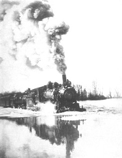
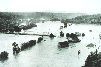
All the photos used in this article are reproduced by courtesy of the NOOA Photo Library, and were taken during floods in the first few decades of last century. Historic and recent photos in this collection are well worth a look
Like to Know More?
Apart from the links in the text above, and the excellent
books, DVDs, videos and other material mentioned in the More Flood Resources pages, you can find out more about the weather conditions that cause floods on the Severe Weather page.
Severe Weather page.
More information on weather Stations can be found on the
Home Weather Stations
page, and there is also a
page to help you
set up your weather station.
Back to the Top, or return to the Home page. You may be interested to know that you can find out more about weather and home weather stations by receiving our newsletter ,"Watching Weather". It's published more or less weekly, and apart from tips on how to use your weather station and understand what it's telling you about the weather around you, it also covers many other weather related topics. If this sounds interesting, just add your name and email address to the form below. When you join, you'll also receive, totally free, a 20 page guide to setting up and trouble shooting problems in home weather stations. And I promise that you won't get spammed, and that your sign up details will remain totally confidential. Sign up now and receive your first issue almost immediately. Last update 05/24/2011
|


