|
Tracking Hurricanes, Recording Hurricanes, And Just What Does El Nino Have To Do With It?The subject of Hurricanes is a big one - in fact it hasspread over five pages of this website. Part 1 - Hurricane Basics was concerned mainly with definitions and the wayhurricanes are named and classified. Part 4, More Hurricane Resources , lists some of the hurricane information, such as DVDs,books and posters, that don't require an internet connectionto be enjoyed. And Part 5 - Ever wondered what it's like to stay on as a hurricane passes overhead? Check out Hurricane Safety for an account of sitting through Hurricane Wilma as it struck Southern Florida in October 2005. But back to Part 2 - this article. Here we'll look athow hurricanes move, why their paths differ from onestorm to the next, and how to use your home weatherstation and other resources when a hurricane is on itsway. Hurricane Tracking Even though a tropical depression may have intensified to a hurricane, its future is by no means clear. A patch of drier air at mid levels, strong opposing winds at height, or an area of cooler water can cause it to fade away.
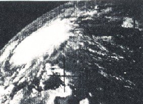
Hurricane Anna, 1964 - the first If it does persist, its future path is difficult to predict. The general trend in the North Atlantic hurricane area is for hurricanes to move to the west with a tendency to veer to the north. The main controlling feature is an east-west axis of high pressure called the subtropical ridge which exists to the north of the hurricane zone. The tendency of many hurricanes is to work their way around this ridge, moving north around its western edge and often curving back to the east. The strength of the ridge plays a significant part in determining whether the hurricane continues west across the Caribbean to Mexico and southern Texas, swings around towards Florida, or curves further towards the north east coast of the USA, even heading out to sea. Study of the overall weather system allows meteorologiststo predict a hurricane's path and likely fate. But hurricanescan last for weeks, and long range weather forecasts arenot the most precise tool in a forecaster's arsenal. Consequently initial predictions can be expected to changeas the hurricane carves its path across the area, andthey need to be updated continuously. Once a hurricane crosses the coast it loses its source of energy from warm sea waters, and begins to degenerate. Winds drop rapidly, and, depending on location in relation to the centre, rain may also cease quite quickly. However, the depression often has some life left in it, and depending on its path, its location, and other weather conditions, it may reform if it returns to warm waters. Otherwise it may become a rain depression and cause major inland flooding, or it may contribute to thunderstorm and tornado development, particularly in southern states. Observing Hurricanes As usual with severe weather, your own safety should be your first and main consideration. If you live in a low lying coastal area in a hurricane's path your best move is to leave, with plenty of time to spare. In the more severe hurricanes (Category 4 or 5) you can expect a storm surge in excess of 12 feet (3.7m). This will begin to cause flooding well in advance of the storm center, and could cut your escape route. A reliable Weather Radio tuned to local warnings must be regarded as essential. So with the sea rising, the rain falling, and the winds horizontal, the best place to be is somewhere else. Apart from anything else, very few weather stations, whetherhome or official, can continue working through a severe hurricane. Damage from strong winds and flying debris is common, and power is almost always lost soon after wind speeds reach hurricane strength. So even if youranemometer keeps spinning at record rates, without poweryou'll have no records to confirm it. 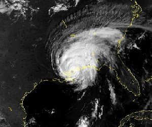 Landfall of Hurricane Georges, In safer circumstances, your home weather station will provide very interesting records of one of weather's major events. If you can reinforce the data with personal observations, photos, or videos. Changes in cloud types,and their direction of movement, are certainly worth noting. You will also be able to keep track of a hurricane's position through satellite images, and, once in range, through radar. Which leads to remote tracking and follow up. When a hurricane is in the area it can easily be tracked by keeping up with watches and warnings on radio, TV, and the internet. The National Hurricane Center has blank tracking charts of the Caribbean/Western Atlantic area available as a pdf file. Satellite imagery is also available, plus other tracking information. Radar may be hard to find until hurricanes are close to the US coast (or Puerto Rico). And after the event is over, you can find a complete and detailed of the history of the hurricane, from its causesto its final disappearance, in the NHC's excellent archive section. Hurricanes and El Nino Since the causes and processes of El Nino/La Nina events began to be understood during the early 1980s, El Nino has been blamed for most occurrences of severe or unusual weather, crop failures, stock market collapses and more. The blame is not always well directed, but these world wide climatic oscillations do have significant effects on weather, particularly in Tropical and nearby areas. But since all El Nino events differ in some respects fromeach other, the responses of weather to an El Nino willnot always be consistent or predictable. However, in the case of North Atlantic hurricanes thereis a clear tendency for fewer hurricanes in an El Ninoyear. There is also a tendency for the hurricane pathsto be further to the east, with fewer landfalls oncontinental USA. In contrast, a La Nina year may be expected to result in more hurricanes. More information on El Nino will be available in a future article. More information can be found among the Severe Weather articles, the links at the top of this page, and you'll find heaps of other great resources -DVDs, videos, books, posters etc - atMore Hurricane Resources
This link will take you back to the Top, or, when you're ready, here's how to return to the Home page. You may be interested to know that you can find out more about weather and home weather stations by receiving our newsletter ,"Watching Weather". It's published more or less weekly, and apart from tips on how to use your weather station and understand what it's telling you about the weather around you, it also covers many other weather related topics. If this sounds interesting, just add your name and email address to the form below. When you join, you'll also receive, totally free, a 20 page guide to setting up and trouble shooting problems in home weather stations. And I promise that you won't get spammed, and that your sign up details will remain totally confidential. Sign up now and receive your first issue almost immediately. Last update 05/24/2011
|